
ESA ers
ESA ersの説明
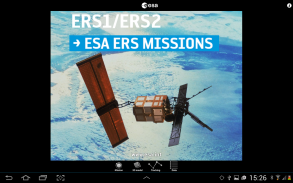
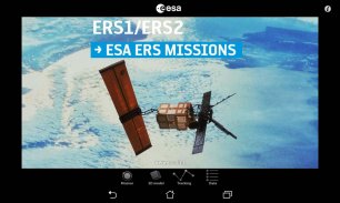
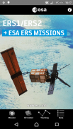
ESA's two European Remote Sensing (ERS) satellites, ERS-1 and 2, were launched into the same orbit in 1991 and 1995 respectively. Their payloads included a synthetic aperture imaging radar, radar altimeter and instruments to measure ocean surface temperature and wind fields.
ERS-2 added an additional sensor for atmospheric ozone monitoring. The two ESA satellites acquired a combined data set extending over two decades.
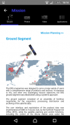
This application is a gateway to knowing what the ESA mission is about, how it works and what the elements of the space and ground segment that makes this mission unique are.
It includes also a dedicated section that allows one to discover and visualize optical measurements over our planet.
Features:
- Description of the ESA ERS missions: space and ground segment
- Large selection of photos and videos on a wide range of topics related to ERS missions
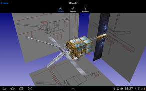
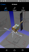
- Striking ERS 3D models with explanations of the different platform and payload elements
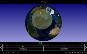
- World map with orbit position of the ESA satellite
- Satellite visibility over selected ground stations and local position
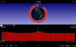
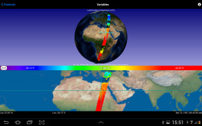
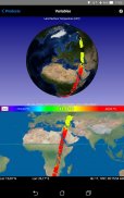
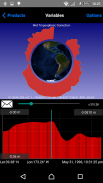
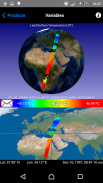
- Impressive visualization of ESA ERS measurements over the Earth with vertical profiles and with acquisition strip over the earth
- Access to several geophysical parameters measured by the satellite
…and much more
In the 3D environment:
- swipe/pinch to rotate/zoom the scene or the satellite model
- triple touch to reset position
In the Data ATSR (Optical) section:
- Zoom the bottom map image by pinching two fingers in or out and drag it with one finger
- The center of the blue cross is a pointer to an optical data value of the selected variable, in a specific point (Latitude/Longitude) at a specific date time
- Position the optical stripe at the center of the map and watch the cursor move above the earth surface
ESA ers - バージョン 3.00
(16-07-2020)ESA ers- APK情報
APKバージョン: 3.00パッケージ: it.acsys.android.esaersappESA ersの最新バージョン
他のバージョン


同じカテゴリのアプリ